


Autel EVO Lite 640T Enterprise
Questions? Call Us
Professional-grade 6K imaging in a lightweight, field-ready platform.
Perfect for public safety, mapping, inspection, and rapid deployment, the EVO Lite 6K Enterprise combines outstanding image quality, AI-assisted flight modes, and rugged design in a single-operator friendly package.
🔍 Key Features
-
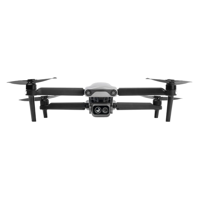
1″ CMOS 20 MP Camera: Shoots 6K/30fps and 4K/60 HDR video, with adjustable aperture (f/2.8–f/11) and up to 16× digital zoom — ideal for professional imaging and AI target tracking.
-
40-Minute Flight Time: Fly up to 40 minutes (forward) and 37 minutes hover with a top speed of 18 m/s — great for extensive missions.
-
Compact & Portable: Weighs just 866 g, folds to 210×123×95 mm — built for swift, single-operator deployment.
-
3‑Way Binocular Obstacle Avoidance: AI-powered sensors in front, back, and bottom ensure safe navigation.
-
SkyLink 2.0 Transmission: Low-latency video feed up to 12 km for confident remote operation.
-
AI Target Recognition: Automatically identifies up to 64 object types for streamlined mission execution.
-
Enterprise Flight Software: Customizable toolbar, split-screen visuals, secure data encryption, and live streaming support for professional applications.
⚙️ Technical Specifications
| Spec | Detail |
|---|---|
| Weight (takeoff) | 866 g |
| Folded Dimensions | 210×123×95 mm |
| Max Flight Time | 40 min forward / 37 min hover |
| Max Speed | 18 m/s |
| Wind Resistance | 10.7 m/s |
| Max Altitude | 3,000 m |
| Camera | 1″ CMOS, 20 MP, f/2.8–f/11 |
| ISO Range (Video) | Up to 44,000 |
| Digital Zoom | 16× |
| Video Capture | 6K/30 fps, 4K HDR |
| Obstacle Avoidance | 3-way binocular vision |
| Transmission | SkyLink 2.0, ~12 km range |
| Storage | AES-encrypted with split-screen & RTMP support |
📦 What’s Included
-
1 × EVO Lite 6K Enterprise Drone
-
1 × Smart Controller V3 (7.9″ HD touchscreen)
-
3 × Intelligent Flight Batteries
-
1 × Rugged Carrying Case
-
Documented Accessories: charger, cables, extra propellers, toolkit
✅ Ideal For
-
Search & Rescue, Law Enforcement
-
Utility & Infrastructure Surveying
-
Forestry and Environmental Monitoring
-
Aerial Mapping & Industrial Inspection
-
Emergency Response and Event Security